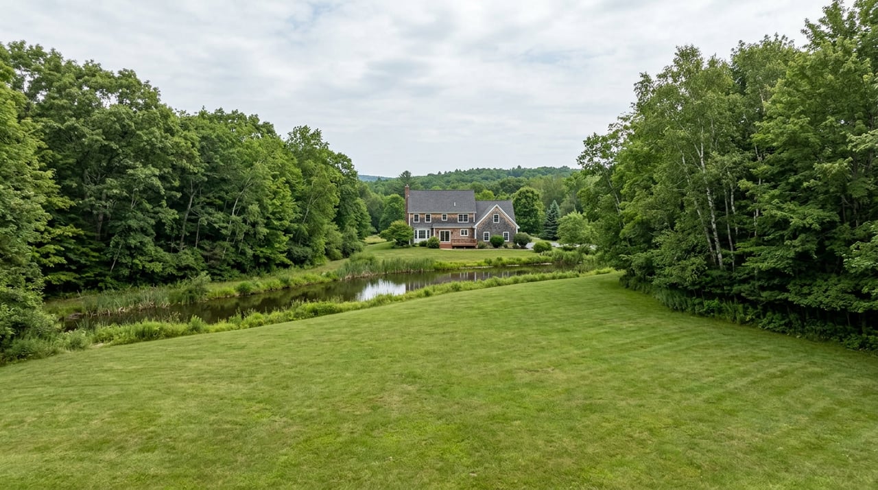
For generations, Lake Hartwell has been more than a beautiful backdrop. It has shaped where people live, how they spend their weekends, where businesses grow, and what buyers are willing to pay for direct access to the water. Now the corps is lowering the lake 4 feet for the next 5-10 years?
However, The U.S. Army Corps of Engineers' August 26 announcement deserves a careful explanation—not panic, speculation, or a one-size-fits-all prediction.
The Corps announced that it will operate Lake Hartwell with a year-round guide curve of 656 feet above mean sea level while it studies, designs, funds, and constructs a long-term solution for seepage deterioration at the Clemson Lower Diversion Dam Saddle Dike. Historically, the lake's guide curve has varied seasonally, reaching approximately 660 feet during the summer and 656 feet during the winter. Under the interim restriction, the target will remain at 656 feet year-round. The Corps will also manage the lake to stay below a maximum elevation of 662 feet. Read the official USACE news release.
This is a major operational change, particularly for the spring and summer months. But it does not affect every Lake Hartwell property equally. Water depth, shoreline slope, dock location, cove configuration, permitted improvements, and access to navigable water will matter more than ever.
As a Realtor who works throughout the Lake Hartwell market, my job is to separate three different questions:
- What has USACE officially announced?
- What are the practical effects on recreation and lake access?
- How is the real-estate market likely to distinguish one property from another?
What USACE Announced
The restriction is an interim risk-reduction measure related to the Clemson Lower Diversion Dam Saddle Dike, part of the Clemson Protective Works built before Lake Hartwell was filled. The system reroutes the Seneca River and helps protect low-lying Clemson University property and infrastructure from flooding.
USACE says active seepage within the Saddle Dike's foundation was discovered in 2015. Water moving through or under an earthen structure can carry away fine soil particles, gradually creating internal pathways through a process known as piping or backward erosion. More recent observations, including information gathered during significant storms such as Hurricane Helene, indicated that the deterioration was worsening.
The Corps has been equally clear about two facts:
- There is no immediate danger to the public, and the emergency action plan has not been activated.
- Without intervention and a permanent repair, the deterioration could eventually lead to failure.
Lowering the operating target reduces the depth—and therefore the pressure—of water against the Saddle Dike while the permanent solution moves through study, environmental review, federal funding, design, and construction. USACE says the Dam Safety Modification Study may take up to two years, while the entire process could take five to ten years or more. The restriction will be re-evaluated annually. See the USACE Lake Hartwell restriction overview and FAQs.
What 656 Feet Actually Means
The most important distinction is between the guide curve and the maximum limit.
- 656 feet MSL is the new year-round operating target.
- 662 feet MSL is the maximum level USACE intends to stay below.
- If a major rain event pushes the lake above 656 feet and toward 662 feet, USACE says it will work to return the lake to 656 feet as quickly as conditions safely allow, with a goal of doing so within seven days.
This does not mean the lake will be exactly 656.00 feet every day. Rainfall, inflow, downstream requirements, hydropower operations, and drought will continue to cause movement. It does mean that buyers and owners should no longer use 660 feet as the assumed long-term summer operating target while this restriction is in place.
There is also no immediate four-foot drawdown caused by the announcement. USACE reported on August 26 that the basin was already in Level 2 drought conditions and Lake Hartwell was roughly eight feet below its normal guide curve. Because the lake was already below 656 feet, the new restriction would not immediately change operations. The long-term difference will become visible after adequate rain returns: the lake will be managed toward 656 feet instead of returning to the historical 660-foot summer target.
Lake Hartwell by the Numbers
The scale of the lake helps explain why the restriction affects so many communities and why no simple market-wide estimate will be accurate.
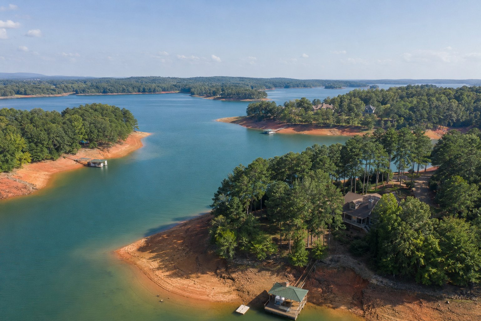
At the historical 660-foot summer pool, USACE reports that Lake Hartwell covers nearly 56,000 acres, includes approximately 962 miles of shoreline, and is surrounded by roughly 24,000 acres of public land. The lake extends into six counties: Anderson, Oconee, and Pickens in South Carolina, and Hart, Franklin, and Stephens in Georgia. USACE also reports a historical average lake elevation of about 657.5 feet MSL. Review USACE's Hartwell facts and figures.
USACE has not, as of this announcement, published a new lake-wide surface-area figure for 656 feet on the restriction page. It would be misleading to subtract four feet and assume the same amount of shoreline retreat everywhere. Lake Hartwell's shoreline is irregular, and every lot has a different underwater slope.
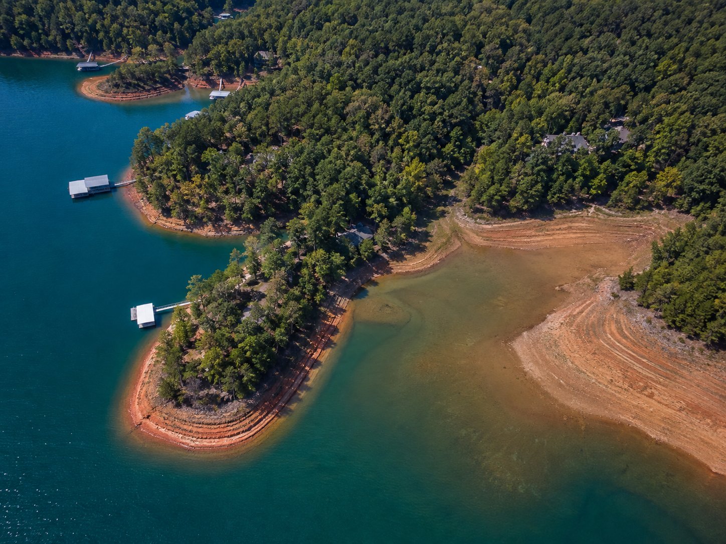
On a steep bank, four vertical feet may produce a modest horizontal change. In a shallow cove with a gentle lakebed, the same four-foot difference can move the waterline much farther from shore. For illustration only:
- A 5-to-1 horizontal slope can translate four vertical feet into about 20 feet of horizontal retreat.
- A 10-to-1 slope can translate four vertical feet into about 40 feet of retreat.
- A 20-to-1 slope can translate four vertical feet into about 80 feet of retreat.
Those examples are geometry, not property measurements. The only responsible way to analyze a particular lot is to measure the water depth, record the lake elevation on the measurement date, examine the cove and channel profile, and verify the permitted dock location.
What Will Change for Recreation?
Lake Hartwell remains open for boating, fishing, and recreation, but USACE expects several practical effects at the 656-foot target:
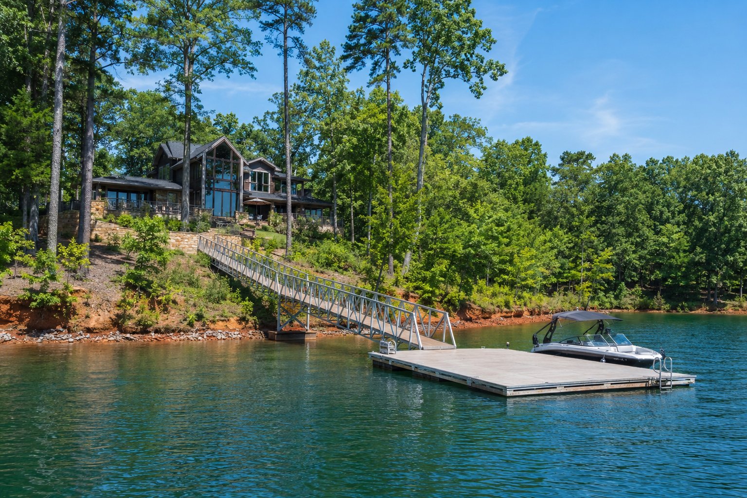
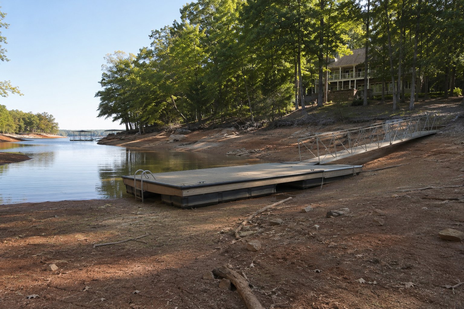
- Private docks: Shallow-water docks will experience dry or marginal conditions more frequently than they did in normal, non-drought summers.
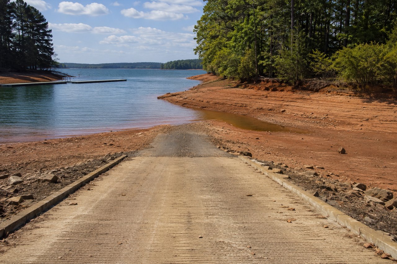
- Boat ramps: Many ramps should remain usable, but some shallow ramps may close or provide reduced access.
- Swim beaches: USACE says designated swim beaches generally become unusable below 657 feet. At the 656-foot target, designated beach areas may remain closed or dry.
- Navigation: Lower levels expose trees, rocks, humps, sandbars, and other hazards. Boaters should slow down in unfamiliar water and rely on current depth information.
- Drinking water: USACE says municipal water intakes remain within safe operating limits at 656 feet.
- Hydropower: The lower pool reduces some water volume and head pressure, although USACE says it is working with the Southeastern Power Administration and utility partners to minimize the effect.
For property owners, the key point is that “lakefront” and “usable water access” are not always the same product. A property can still border Corps land and have a permitted dock while offering less reliable boating depth at 656 feet.
What Historical Data Says About Lake Levels and the Local Economy
There is meaningful historical evidence that Lake Hartwell's elevation affects recreation and real-estate activity, but the evidence must be read correctly.
A USACE-funded economic analysis used monthly data from 1998 through 2009, including lake levels, visitation at Corps facilities, retail activity, and 9,736 transactions involving lake-access parcels in the six counties bordering Hartwell. The study estimated that each one-foot increase or decrease in lake level was associated with approximately 21,200 more or fewer monthly visitors to USACE facilities, holding season and broader economic conditions constant. That figure represented about 2.5% of average monthly visitation.
For the April 2007 through December 2008 drought period, the model estimated approximately 56 fewer lake-access real-estate transactions, or about 3.5% of the 1,605 transactions that occurred during the period. Anderson County represented the largest estimated numerical change, with about 32 fewer transactions, while some smaller Georgia counties experienced larger percentage changes. Review the economic analysis hosted by the South Carolina Department of Environmental Services.
That study provides strong directional evidence that lower water can reduce visitation and transaction activity. It does not prove that every four-foot reduction produces a fixed percentage loss in property value. It analyzed an earlier period, including an extreme drought and the 2007-2009 financial crisis, and its real-estate result addressed transaction counts rather than a universal price discount.
It would therefore be irresponsible to announce that “all Lake Hartwell homes just lost X percent.” We do not yet have closed-sale evidence from the post-announcement market to support such a claim.
My Real-Estate Assessment: The Market Will Become More Selective
My professional expectation is that the 656-foot restriction will cause greater separation within the Lake Hartwell market, not one uniform change across every shoreline property. This is an informed market inference based on the Corps' operational plan, the documented recreation effects of lower water, and how lake buyers evaluate utility. It is not a formal appraisal or a measured 2026 price result.
Deep-water and main-channel properties
Properties with dependable depth at 656 feet, strong channel access, well-positioned permitted docks, and attractive year-round views should be the most resilient. In fact, their relative desirability may increase because truly dependable water becomes scarcer.
A deep-water property does not become less useful simply because the summer target changes from 660 to 656 if the dock and approach remain fully functional. Buyers may place an even higher premium on documented depth and navigability.
Moderate-depth coves
These properties require parcel-specific analysis. Four feet may reduce the boating season, limit the size of boat that can be kept at the dock, require lift adjustments, or make the dock marginal during dry periods. Other moderate-depth coves may remain entirely workable.
This middle category is where accurate measurements, honest marketing, and the selection of truly comparable sales will matter most.
Shallow coves and upper tributary locations
Properties with shallow dock sites, long flat shorelines, or restricted access to deeper channels face the greatest potential pressure. The likely effects can include:
- More frequent dry-dock conditions
- Longer walks or gangways to the water, where permitted
- Reduced boating convenience
- Greater buyer objections and negotiation leverage
- Longer days on market if the property is priced as though it offers dependable 660-foot summer access
The house itself may remain excellent. The adjustment is to the utility and reliability of the lake amenity—the feature that often creates a substantial portion of the waterfront premium.
Lake-view, lake-access, and off-water properties
Homes that do not depend on a private dock may experience more indirect effects. A neighborhood with a deep-water community marina could remain very attractive. A property relying on a shallow public ramp or designated swim beach may face more inconvenience. Lake-view homes may see a wider band of exposed shoreline during normal summer conditions, but their market reaction will depend on the actual view corridor and buyer expectations.
Marinas, vacation rentals, and lake-oriented businesses
Lower water can affect traffic patterns, ramp availability, marina operations, seasonal rentals, restaurants, boat service businesses, and other recreation-dependent activity. The historical economic study indicates that visitation responds to lake elevation, but the size of the 2026 impact will depend on drought recovery, ramp access, public communication, and how quickly businesses adapt.
Why Appraisals and Comparative Market Analyses Must Change
The restriction adds a new comparison dimension to Lake Hartwell valuation. It will no longer be enough to compare houses by square footage, age, condition, lot size, and whether a dock exists.
A credible lakefront analysis should also compare:
- Water depth at the permitted dock location at a common reference elevation
- Main-channel, secondary-channel, or cove position
- Distance and navigability from the dock to dependable water
- Shoreline and lakebed slope
- Dock size, configuration, condition, and permit status
- Fixed versus adjustable gangway and lift limitations
- Exposure of the lakebed and effect on the view at 656 feet
- Nearby public ramp or marina access
- Historical performance during prior low-water periods
A closed sale in a deep-water channel should not automatically be treated as equivalent to a similar-sized home in a shallow cove. Conversely, sellers of dependable deep-water property should not accept a broad “the whole lake is four feet lower” discount unsupported by the actual functionality of their property.
As sales close after August 26, we will need to track sale-to-list ratios, days on market, concessions, failed contracts, and price per square foot by water-depth category. That is how a defensible market adjustment will eventually emerge.
A Practical Due-Diligence Checklist for Lake Hartwell Buyers
1. Measure the water—and document the lake level
Do not rely on “deep water” in a listing description. Measure the depth at the dock and at the route to the channel. Record the date and the official USACE pool elevation that day.
To estimate depth at the 656-foot target:
Estimated depth at 656 = measured depth + (656 - pool elevation on measurement date)
For example, if the lake is at 652 feet and the dock has six feet of water, the same location would have approximately ten feet at 656, assuming the lakebed has not changed. If the depth was measured at 660 feet, subtract four feet to estimate depth at 656.
2. Test the entire route, not only the end of the dock
A dock can have sufficient water while the cove mouth or approach contains a shallow bar. Confirm navigable access from the dock to the channel at the relevant pool elevation.
3. Verify the permit directly with USACE
USACE states that prospective buyers should contact the Hartwell Project Office before purchasing adjacent property. Shoreline Use Permits are not transferable; an existing permit becomes void when the adjoining private property changes ownership, and the buyer must apply for a new permit. Some grandfathered facilities may not qualify for re-permitting after a sale. A dock already in place is not an automatic guarantee that the new owner can keep it. Review USACE's permit guidance and shoreline management FAQs.
4. Confirm shoreline allocation and boundaries
Green, yellow, red, and orange shoreline allocations allow different levels of private use. Dockability depends on allocation, location, spacing, and a Corps field inspection. Also remember that land between the private boundary and the water is generally federally owned public land, not an extension of the homeowner's private yard.
5. Evaluate the dock as a system
Review the gangway length, anchoring, flotation, lift range, electrical service, walkway slope, and ability to reposition the structure. Do not assume an extension, relocation, dredging project, or vegetation removal will be approved. Obtain written USACE guidance before assigning value to a possible modification.
6. Review access alternatives
If the private dock becomes marginal, is there a reliable neighborhood ramp, deep-water marina, or community slip nearby? USACE expects some shallow ramps to close at lower levels, so verify the actual facility rather than relying on distance alone.
7. Use low water as an inspection opportunity
The present drought can reveal lakebed slope, obstructions, riprap condition, old structures, stumps, and channel depth that are hidden at higher water. Photograph and measure what you see. Low water can provide unusually valuable due-diligence evidence.
8. Make the contract match the risk
Where appropriate, buyers should discuss due-diligence language with their Realtor and closing attorney concerning shoreline permits, dock condition, water depth, surveys, and access. A Realtor can gather market evidence, but legal interpretations should come from an attorney, engineering conclusions from a qualified engineer, and formal value opinions from an appraiser when required.
What Lake Hartwell Sellers Should Do Now
Sellers should avoid both extremes: minimizing a material change or assuming the property has automatically lost value.
Document the property's strength
If your dock remains functional at today's drought level, that may be compelling evidence of durable water access. Record the current USACE elevation, water depth, photographs, and navigable route. Organize the Corps permit, dock plans, surveys, and maintenance records.
Market the actual utility
Specific facts will outperform vague phrases. “Eight feet of water at the dock when Hartwell was at 652 feet” is more useful than “deep water.” The measurement should be dated, explained, and independently verified when material to a buyer's decision.
Price against the right competitors
Deep-water property should be compared with other dependable deep-water property. A shallow cove should not be priced solely from a main-channel sale because both have a dock. The water-access adjustment must be addressed directly.
Expect informed questions
Buyers will ask about 656-foot depth, dock re-permitting, access to the channel, exposed shoreline, ramps, and the repair timeline. A complete information package can reduce uncertainty and help prevent a late renegotiation or failed contract.
What This Announcement Does Not Mean
It does not mean Lake Hartwell is closing.
It does not mean there is an immediate dam failure.
It does not mean USACE is suddenly removing four feet of water from the drought-stricken lake today.
It does not mean every dock will be dry.
It does not mean every lakefront property has lost the same percentage of value.
It does mean that 656 feet—not 660 feet—should be the new baseline for evaluating summer water access while the restriction remains in effect.
What Owners and Buyers Should Watch Next
The market will receive more information as the process advances. Important milestones include:
- USACE virtual public information sessions expected in September 2026
- The draft Environmental Assessment and public-comment process
- In-person sessions anticipated in November 2026
- Completion of the Dam Safety Modification Study
- Selection and federal funding of a permanent engineering solution
- Annual review of the lake-level restriction
- Local sales evidence from properties closing after the announcement
The Lake Hartwell Association email accompanying the attached press release also announced an October 15, 2026 meeting at the Anderson Civic Center, with a USACE representative expected to discuss the restriction and answer questions. Owners should confirm final event details directly with the Association.
The Bottom Line
Lake Hartwell remains one of the Southeast's most important and desirable recreation lakes. Its scale, access, natural beauty, and connection to Anderson, Clemson, Seneca, and the broader Upstate are not erased by this restriction.
But the rules of valuation have changed.
Under a 656-foot year-round target, dependable water depth becomes a more important real-estate asset, shallow-water limitations become more visible, and broad labels such as “waterfront” or “dockable” become less useful without documentation. The most informed buyers will purchase based on function at 656 feet. The best-prepared sellers will prove that function with measurements, permits, photographs, and property-specific market evidence.
If you are considering buying or selling on Lake Hartwell, the right next step is not to guess at a lake-wide percentage. It is to evaluate the exact property—its water depth, cove, dock, permit history, shoreline allocation, comparable sales, and likely buyer response.
That is the difference between reacting to a headline and making a sound real-estate decision.
David Locke, Realtor®
Locke & Key Associates at Keller Williams Western Upstate
Lake Hartwell real-estate guidance for buyers and sellers throughout Anderson, Oconee, and Pickens counties.
This article is for general real-estate information and is not an appraisal, engineering opinion, legal opinion, guarantee of water level, or prediction of a specific property's future value. USACE operations and project timelines may change. Verify current conditions and permit information directly with the U.S. Army Corps of Engineers.